Field Diary 2025

I very rarely have time to write a proper field diary, our time in the field is usually extremely hectic and filled with 12-18 hour working days that blend seamlessly together. I suspect this week is also going to be busy, but Nature has offered an olive branch in the shape of an early break-up of the sea ice, so I’m taking a moment to write a few things down. Updates will be posted at the top so scroll down to read the first day.

And finally…

I’m writing this on the metro home, I’ll spare you the flight delays, the packing up dramas, the last minute, “just one more snow pit”…

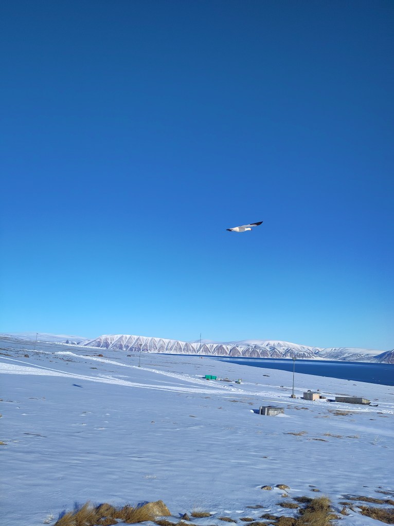
Melville Bugt from the air

 It was a good tour. Enormous amount of work done, perhaps more importantly, it has also been foundational work, on both data and field site management, it will be much easier for colleagues to help us maintain this and to build up a long term data set of all the observations (and more that I haven’t written about here) in future. That should reduce costs and field time in the future but also give others the opportunity to visit and do their own research up here.

The traditional hunters gloves turn out to be by far the best thing to work in when programming outside. You can put your hands in and out very fast and they are super warm.

I think streamlining the storage of data is extremely important. There is far too much data in the world on hard drives and in field notebooks, doing no good to anyone. This system will be much easier for other colleagues to use what we have collected and we will be able to publish them outside of DMI soon too. I remain committed to FAIR publishing, but I often feel the barriers are practical rather than psychological.

I’ve also introduced my new(ish) colleague Abraham to the Arctic. Given he grew up in a place without snow it has been a delight to watch him discover the processes and problems that I’ve been working on the last 20 years and that we’ve been discussing together the last 18 months.  I believe it’s extremely important for climate modellers to understand and see the system they’re trying to model. This trip has definitely confirmed me in that. This was not just a field campaign but also a pedagogical field trip in some ways too. We have also had the opportunity to brainstorm a lot of new research ideas along the way, there is rarely such time in the office, so plenty more to work on in coming years..
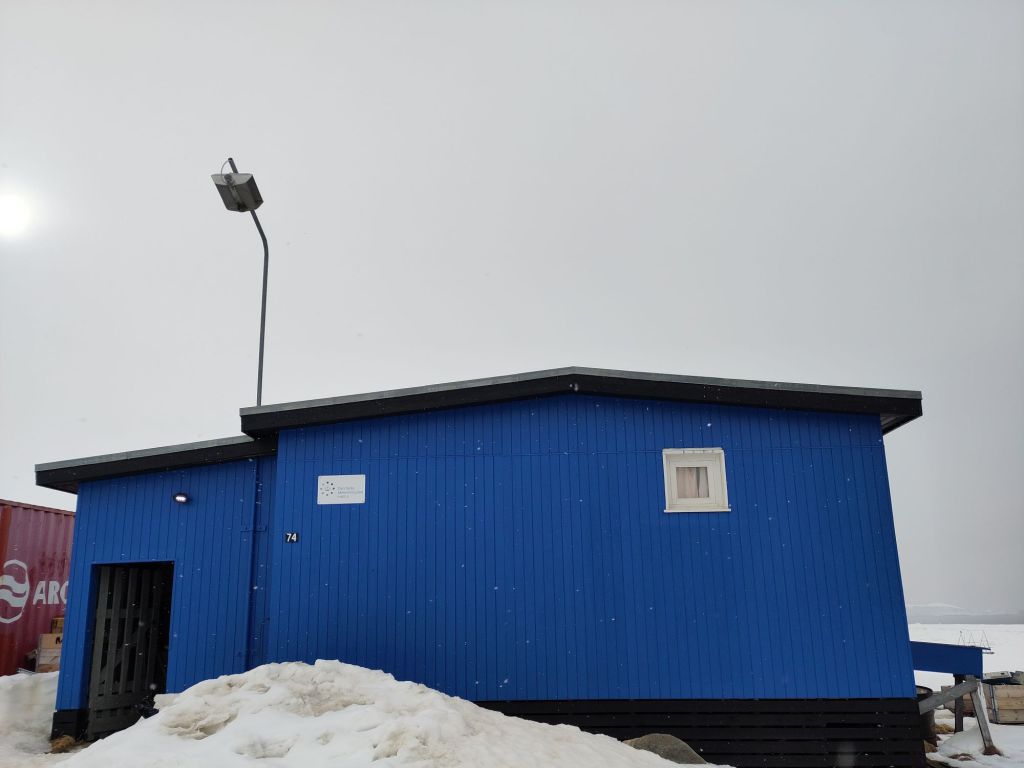
The DMI geophysical facility, newly painted!

As ever massive thanks to many colleagues, especially Aksel our DMI station manager without whom this work would be close to impossible given he is both interpreter and collaborator on the practical observations; Qillaq Danielsen for taking us out on to the sea ice with his sled. Steffen for running an extremely valuable long-term programme, Andrea for helpful and practical discussions and of course Abraham for making it a very good week. Glad we got to do this.

I should also say a large thankyou to my husband for keeping the home front running smoothly along whilst I am travelling. None of this would work otherwise.

Tak for denne gang Qaanaaq!

Day 6: Last day

It’s amazing how fast the tine goes, our last full day in the field (we’d originally planned for 9 days, but that was partly because last year we planned a week and it got cut to 3 days due to flight weather problems, I learned and left a safety margin this year). Nonetheless, a busy day. As we’re really interested in lots of different processes that combine in what we call the Arctic Earth System our focus for today was twofold, looking at the atmosphere and the subsurface, both of which are partly other scientists projects, but giving data we really want to use with our climate model, both for evaluation and development.

Aksel and Abraham giving the site a few last tweaks

The main aim was to finalise the snow site ready for observations over the next year. We finally reinstalled the remaining FC4 and new logger, this has been ticking over and being tested in our station kitchen for the last couple of days. I’m rather pleased with myself in managing to get these 2 talking to each other, I was envisaging a bigger struggle, but the Campbell Scientific software is very easy to use with good user guides.

The installation was the last element for the snow site and after Aksel and Abraham’s sterling work in building our new logger station, it was trivially easy.

Et voilá! We have a fully functional snow site…

The experience with the new Campbell system proved invaluable in the next task, downloading a whole bunch of data from colleagues’ weather stations for shipping back to Denmark. Normally, we would have been a bigger crew to handle work on the sea ice as well as at the station, but as the sea ice broke up so early (see Day 1), our local hunter friends had taken them down and brought them in to Qaanaaq for us. They needed a bit of repacking, data downloads and checks and we set up a skin temperature calibration station for the satellite group, which I think will also be quite interesting for us in polar regional climate modelling to use. This we left overnight for longest possible calibration.

As we have many collaborations we also spent an hour trying to collect some data from the subsurface permafrost sensors installed by our colleagues at the University of Copenhagen. Unfortunately, it appears they need rather more maintenance than we can provide, so that will need a full team. I am extremely keen to see the data though, ten years + of permafrost and temperature measurements is a seldom dataset and will be super interesting to use in the further development of our surface scheme. Qaanaaq is somewhat vulnerable to permafrost disturbance as it is built on sediments, so monitoring this in a warming climate is pretty important.

A long day, but made even longer by the excitement of narwhals in the bay! We headed out to the ice edge at 11pm, (the polar day plays havoc with your body clock), where quite a few hunters had gathered and were busy slicing up a freshly caught narwhal, eagerly filmed by at least one of the several film crews and photographers there appear to be in the town right now. We have noticed increasing numbers of film crews visiting this part of the world. It can be surprisingly busy.

Greenland does have a strictly regulated quota on narwhals, it’s an important part of the culture, but it is a bit brutal to watch if you’re not used to seeing animals sliced up. Personally, I think everyone should see where the meat they eat comes from. It would make us all more honest about agriculture. But I digress, I was actually more excited to see live ones out in the bay. We’re immensely fortunate to see them, this is only the 2nd time in 5 years I have seen live narwhal here, and it’s only really because the ice has shrunk so early allowing them in. I have immense respect for the hunters who go out in flimsy lightweight kayaks to harpoon them. That must take some courage.

It’s such a peaceful scene, hard to imagine the life and death struggle implied here.

UPDATE: And as an aside, our ace colleagues and collaborators at the Greenland Institute of Natural Resources have a wonderful series of videos exploring all kinds of research in Greenland, including this brilliant one featuring Malene Simon Hegelund and my DMI colleague Steffen Olsen, together with Qillaq Danielsen who we were also out with this year, which really gives a flavour of fieldwork in Qaanaaq and just how important our collaborations with the local community and Greenlandic scientists are.

Day 5: Glacier Day!

As an unrepentant glaciologist, I always look forward to glacier day, when we get up onto the land ice. In this case it’s only a tiny outlet glacier from a rather small local ice cap (well I say small, in the Alps it’d be considered quite large, but by Greenland standards it’s small but well studied). It’s easily accessible and the point about today was to take surface snow measurements and density profiles, so accessible is good.

The deep soft snow that has been a bit of a bane everywhere this year was also a problem. It was very heavy going, there isn’t really a path, just very loose rocks in a (at this time of year dry) riverbed, which is bad enough in summer but when covered in 30cm of snow was quite heavy going. Nonetheless we made a decent pace and got quite high up. By the time we came down again, the outwash river was starting to show signs of life again. It was a cold day, between -3 and -5C but the blazing sunshine alone is enough to start to generate melt and we saw plenty of signs of radiation driven melt going on under the surface snow crust, especially where there were dust layers to accelerate the process.

The snow pits proved indeed how cold the snow has been, typically around -10C at the bottom of the pits, but in one we also found signs of refrozen melt water, perhaps from the brief March warm period?

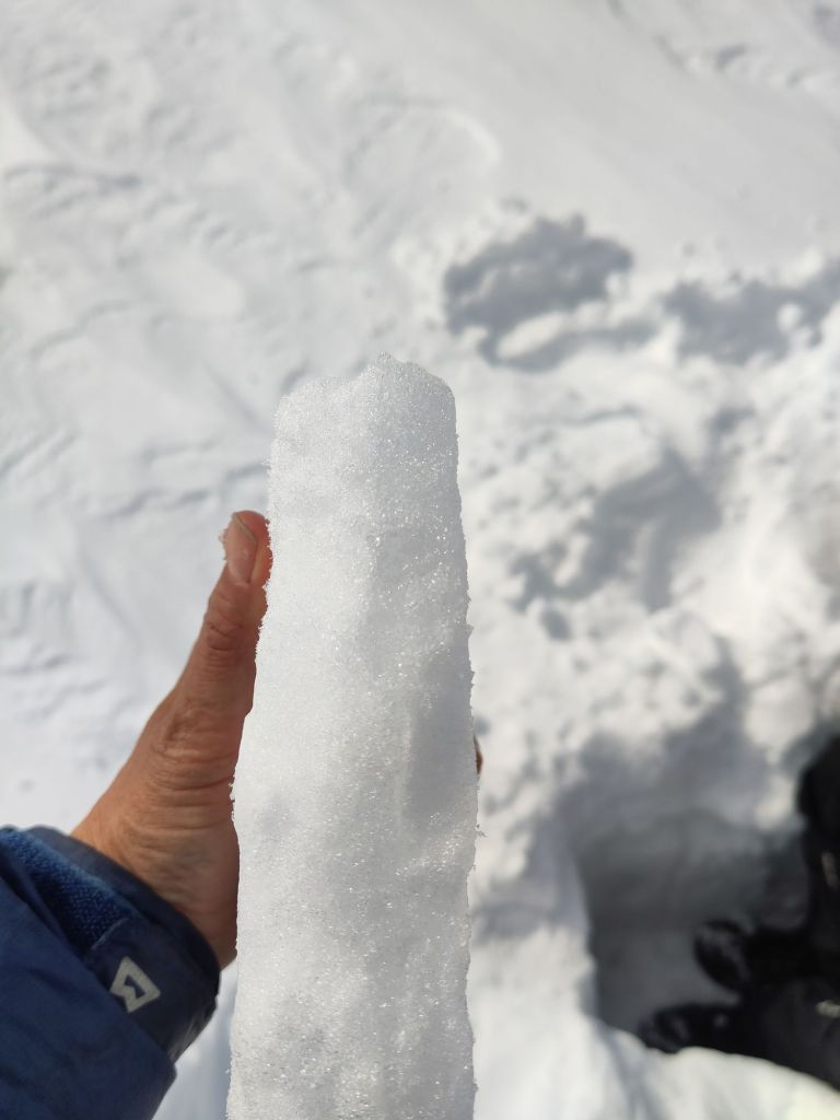
Ice layers in the snow, surprisingly difficult to photograph, you’re going to have to trust us on this one!

We did a transect down with our borrowed infrasnow, made several density profiles and had quite an efficient time. The idea is to repeat this transect at different times of the year so we can see how the snow properties change. In particular, I’m interested in surface albedo (how much incoming light is reflected by a surface). The reflectivity of the snow and ice surface is extremely important for the energy budget, which in turn controls how fast the snow (and ice) melt as well as being important for satellite data retrievals of surface temperature.

The Infrasnow is a very neat device that measures density and specific surface area. It’s not quite the same thing as albedo but it will help us to develop our albedo scheme in the model as it is based on grain size. Unfortunately it does not work on glacier ice, which is some places we also saw peeking out the top where wind has scoured the surface snow away. The movement of snow by wind is the subject of our final full day in the field. 

Lethally smooth glacier ice clearly visible beneath fresh surface snow

We continued the observations off the glacier all the way to the road so we have a nice base transect that can be repeated to assess how conditions change through the year.

Although we only hiked 10km, it was quite tough, so next year we’ll bring snow shoes…

Tomorrow is our final full day. Lots more to do.

Day 4

Day 4 was pretty typical of the highs and lows of fieldwork. We finished (or I should say my colleagues finished) a new mounting for the snow site logger box so hopefully the icing problem will be reduced, we (re-)installed all the instruments except for the new loggers and generally tidied up. It’s looking pretty nice now. This was a high.

Part way through the reinstallation at the snow site

Then, I struggled and failed for about 4 hours to try and get the snow drift sensors to talk to the new logger. That was frustrating low. low. However, a walk around on the fast ice in the bay to try and take a new sea ice core was some valuable breathing space – a little bit of rewiring later and the first numbers started ticking in as planned…. Hurray! That was a high!

It’s immensely satisfying solving these kind of problems. And it was the first time I’ve programmed one of these loggers – new skills are also always rewarding to learn, even if the process is frustrating. I’ve learnt a lot about SDI-12 interfaces and how the instruments actually work too. I need to remember to give myself more deep work time back in the office too. It’s much more personally rewarding and advances the science much more than endless emails and meetings.

While the attempt to get an ice core was interesting, ultimately we failed due to very broken and uneven ice that made access to the part of the sea ice we wanted to get to with our kit too difficult – that was a low. I am simply counting the attempt as my evening walk, in which case maybe it counts as a high? I’ve often thought of Caspar David Friedrich’s famous Arctic painting The Sea of Ice in the coastal part of the fast ice. It’s spectacularly fractured and churned up, though FReidrich’s ice blocks are a little too angular – the real sea ice flakes are a bit more rounded.

Where the fast ice meets the land…

We also did lots of preparation for day 5’s trip to the local glacier, planned a final UAV structure-from-motion mapping campaign on land and got software working to download data on permafrost from sub-surface loggers for colleagues at the University of Copenhagen – that will all however have to wait until tomorrow, our last full day in the field. Today, we have a date with a tiny local glacier.

Day 3

I’d originally assigned only one day in the fieldwork plan for the snow site work, but given we missed our prep day to go directly into the field, we have missed a few crucial steps, so we have been busy today trying to catch up, but mostly in the workshop here at the DMI geophysical facility in Qaanaaq with a couple of visits out to the snow site.

I realised I haven’t introduced the snow site.
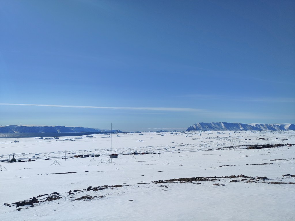
View over towards the south west from the old ionospheric research station on the edge of Qaanaaq. Our snow site in the foreground. It has a great view, if you ignore the town dump at the coast!

It is a small area on the edge of the village (unfortunately near the town dump, but otherwise perfect) where we are conducting a long-term (hopefully) series of observations – we’re currently only at the end of the first year so there are a few teething troubles to sort out. We’re installing a new logger for our snow drift sensors, adding a new snow cam and downloading data from the current one. We also have a standardised set of measurements of snow properties (density, temperature, reflectivity) that we carry out whenever time and opportunity permits, that we will hopefully use to better understand how the snowpack evolves through time. The land based side is a kind of complement to a longer set of observations I have from throughout the region – all point measurements made at rather random times and locations, so the constant monitoring site will hopefully help us to understand the wider context in space and time of those point data. In fact I have a student workign on digitising that data now, so I hope to soon make available the whoel dataset for research purposes.

Snow is incredibly important in the Arctic: it forms an insulating layer over sea ice that prevents futher formation in the winter, but also helps to stop or delay surface melt in the spring and summer. On land, the insulating properties of snow also help to preserve vegetation, insects and mammals through the winter, with specific vegetation assemblages being very much determined by the local snow patterns. And that’s without even discussing the importance of snow to glaciers and ice sheets.
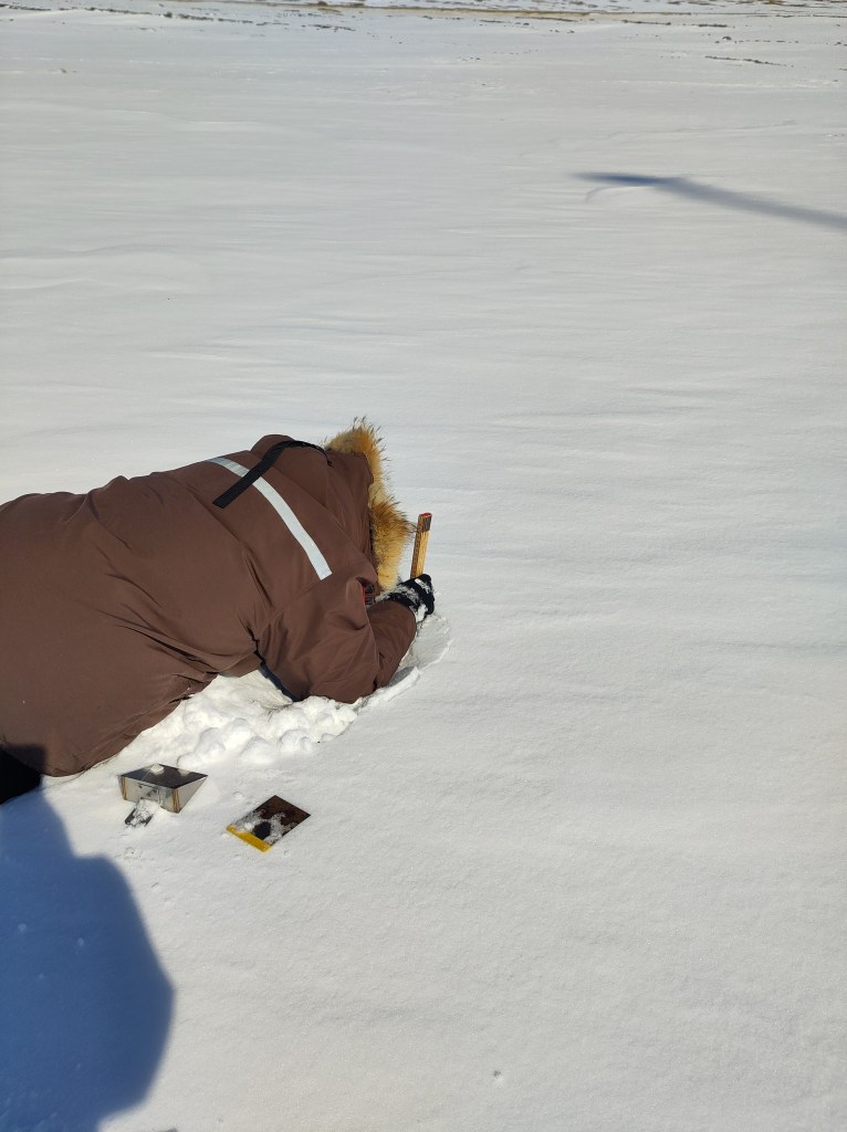
Do you want to do a snow pit? (I asked) Yes! said my colleague. It’s always good to get the modellers to understand just how hard observations can be.

However, it turns out to be difficult to measure when it falls, difficult to work out how much blows around, challenging to model when it melts and when it refreezes and generally a larger than we’d hope uncertainty in weather and climate models. Much of the work developing parameterisations that describe snow properties has been done at lower latitudes too. High Arctic snow is certainly different in many respects to more southerly locations and that needs to be accounted for.

Hence the establishment of our snow programme. Which sounds rather big and impressive, but we’re hoping to set it up sufficiently smoothly this year that it will almost run itself with minimal input from us and assistance from colleagues. Let’s see, there are still some teething troubles to sort out.

The sea ice has now cleared out of a huge part of the bay in front of Qaanaaq and the hunters have been busy taking boats out from the edge of the ice so there are clearly narwhals expected soon. Although, we’ve spent most of the last two days indoors, I keep looking outside, hoping to see some of the marine mammals that visit here. There are already masses of sea birds arriving. Yesterday managed to spot a rather handsome snow goose couple on my evening walk at 11pm.

On my evening walk today I went to the very eastern edge of the town to get a look at the sea ice in the fjord – it’s quite clearly retreating rapidly now; much of the area we travelled over on Friday has gone.

View down Inglefield Fjord with the sea ice breaking up in the distance

Day 2

After Day 1’s rather hectic and busy time, Day 2 was assigned post-processing status. We had a slightly later than the 6am start yesterday, and put some serious effort into assessing our results from the previous day. That means downloading data, clearing up wet kit to dry it off properly, repacking stuff we don’t need further. Then there is the computer work, doing some initial processing, backing up files, writing field notes and doing some measurements (of salinity) on the sea ice cores we collected.

Conductivity/salinity measurements of a melted sea ice core in the workshop, fieldwork is very diverse. And fun.

We also made time to visit our snow site to download data from the instruments there. Unfortunately, it was clear that we need to somewhat reorganise the site, the logger box was completely snowed in, and I was a bit sceptical there would be any data at all. So we collected in some of the instruments for testing and further data downloads in the workshop instead of trying it out in the field. In fact, fieldwork means a lot of tidying up and computer work! I used the opportunity to reorganise and standardise the way we archive all our data, including the UAV images as well as the meteorology instruments, which will also hopefully mean we have an easier time to find and use it in the future.

It wasn’t all laptop work though, we did a few snow pits and some further testing of the Infrasnow system we have borrowed. I’m actually quite impressed with it – very straightforward to use and very consistent data produced.

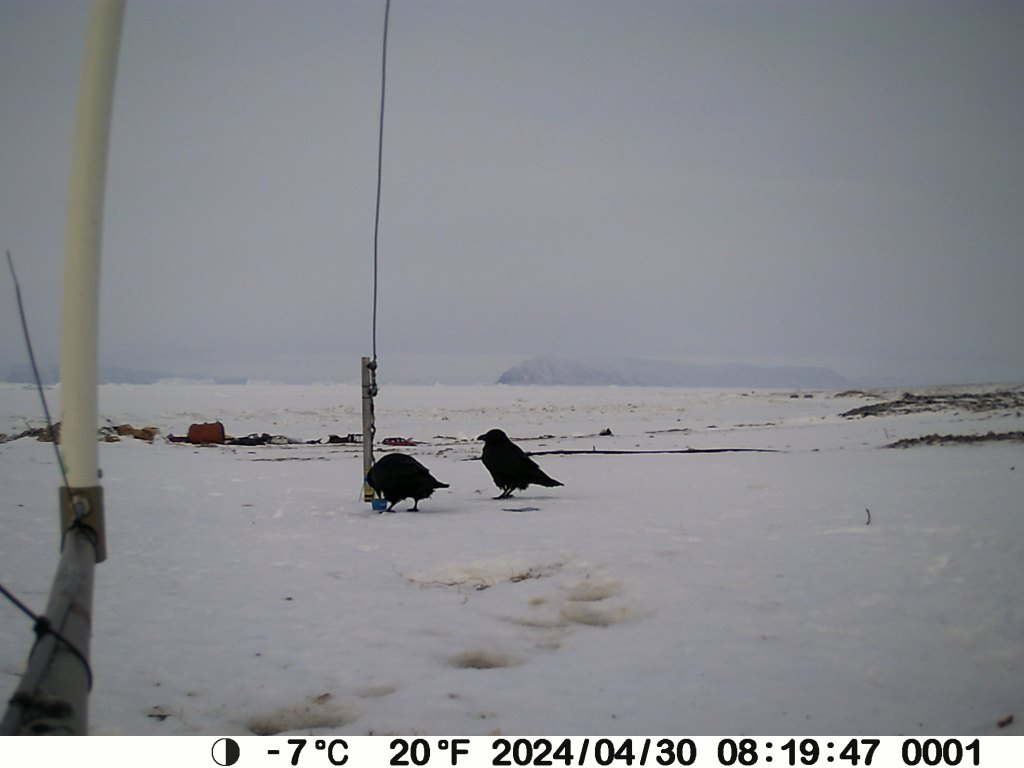
It’s also always fun to check our snowcam – this takes a photo of a stake every 3 hours to monitor the depth of the snow pack, and quite often we get beautiful views and some cheeky ravens hopping past too – I live in hope for an Arctic fox, or even a bear.

Two ravens in the snow, exploring some leftovers apparently.

On the subject of bears, I had heard there were rumours of one near the snow site, but sure enough there were the footprints – rather small and filled in with snow but quite distinctive and heading up towards the ice cap. We shall be extra careful when we go up on to the glacier later this week.

Day 1

We had originally planned terrestrial, glacier and sea ice work, primarily focused on snow processes. The sea ice part though was altered and expanded when the rapid break up in April and again this month was observed. Normally, we’d have a preparation day between arrival and going into the field, but the threat of winds and high temperatures meant we decided not to risk it and we went out straight away on the first full day. Our instincts to just go yesterday turned out to be correct, we had perfect weather and with the help of Qillaq, one of the local hunters we still made it out on to the sea ice. So all is not lost. I woke up this morning to see a wide blue sea just off the last pieces of fast ice on Qaanaaq, so I’m very happy with that decision. Sentinel-2 captured this yesterday while we were out in fact.

It probably looks more dangerous than it is. We were working on the stable fast ice to the east of the big flake, that stretches right into the fjord. The local topography make it very stable and our measurements yesterday confirmed it’s pretty typical for the time of year in thickness, though there was a surprising amount of snow on top, which can actually help to protect the ice from melt at this time of year.

Getting around the coast was surprisingly straightforward, the fast ice has a very stable platform, though some large churned up part of the ice with cracks made for some slightly bumpy manoeuvres to get on and off the stable parts.

Manoeuvring the sled through the coastal zone

The dogs were I think happy when it was over. But in fact it was much more straightforward than I’d feared. The large crack we noticed earlier in the week that opened into a wide lead further extended while we were out, see below, and I woke up this morning to a wide open lagoon. It’s an extraordinarily beautiful place to work and I feel so privileged, especially on days like today when the weather is also being extra nice.

Happy dogs on the way home. Note the large area of open water behind that opened up while we were out.

Work wise it was a successful day, we managed 2 stations, where we did very extensive work. I’d have liked a third but the deep snow made it very heavy and slow going to travel on and in spite of the early start we basically ran out of time and had to return home.

Qillaq and Abraham taking a manual measurement of snow depth and ice thickness next to target for the UAV calibration flights.

We flew the UAV for surface properties, did a lot of snow pits and snow surface properties work, drilled some ice cores (which I will be working on this morning) and even got our loaned EM31 working to do automated ice thickness mapping. We will hopefully start to look at the data later on today to make sure it makes sense before we leave on Thursday.

Our first sea ice core of the season

The reduction in ice means we can actually concentrate on the terrestrial part of the work plan for the rest of the week. And there’s a lot to do!

Last year I set up a semi-permanent snow site to monitor conditions on land through the year. It is going to get a bit of an upgrade this week with some new instruments and of course we need to get the rest of the data downloaded and processed from here too.

Onwards.

Falling Apart…

I’m writing this from a hotel room in Ilulissat, rather than Qaanaaq where I had intended to be arriving shortly, because our plane has been cancelled due to bad weather (at time of writing the airport was measuring gusts of 14 m/s, so I’m actually quite glad it was cancelled).

Weather and flight cancellations are an eternal hazard when doing fieldwork in Greenland, but in this case it also means an impact on our planned fieldwork, because the sea ice is falling apart. And rather earlier than usual (though we have not yet done a systematic review to prove this). In fact, part of the reason for coming here in May (instead of my usual March trip) was to investigate an interesting event that happened earlier this spring. In the animation of satellite pictures below you can see the sea ice rather dramatically falling apart in mid-April and then again at the end of April.

The March to May sea ice season from Sentinel 2 in NW Greenland

To understand what is happening and why it’s unusual, first a bit of background. As I have written before, my DMI colleagues have been working up in NW Greenland for about 15 years on a programme of ocean measurements in the fjord (see map below). I joined about 5 years ago, working in the melange zone of the glaciers at the head of Inglefield Bredning (PSA: a paper we recently submitted about this programme will hopefully be online soon). We use the sea ice as highway and stable platform for observations, so it’s pretty important for us and came to the conclusion it wa squite important for some parts of the glaciers too. The local community, with whom we work closely use it also for travelling, hunting and fishing from. It’s extremely important for them.

The region of North West Greenland we’re talking about

Normally there’s pretty thick (~1m) sea ice covering the whole of Inglefield Bredning (Gulf of Inglefield, also known as Kangerlussuaq, but not that one) out to the islands of Qeqertarsuaq and Kiatak. You can seen an example of what this looks like normally in the satellite animation from 2020, which happens to be when my first trip out on to the sea ice in Qaanaaq took place at the end of May and beginning of June. We were actually very lucky, we had great weather, got very close to the ice edge and watched narwhals swimming out in the North Water polynya. (Yes, sometimes I wonder how I managed to get this job too). The animation below is Sentinel-2 images as cloud free as I could find them from that first field season. As you can see, the sea ice already in March was much much more extensive than this year at the same time. And perhaps that is part of the answer.

It’s probably worth pointing out at this stage that although there were some pretty warm (unusually so) spikes in March and April, the sea ice breakup in April was probably largely driven by ocean swell, and perhaps some winds which were strong, though not excessively so as far as we can see in the observations. The latest break-up seems to be driven also by high winds.

Back to our current field season. We had in fact planned a brief trip up here already – I am currently setting up a project looking at snow processes with the team and we had planned to install and test some new instruments and protocol that we hope to use in Antarctica later this year (more on all of that later hopefully). However, as the soon to be published preprint shows, I and the team have developed pretty extensive sea ice interests recently, so this unusual behaviour rather piqued our curiosity.

We have a lot of questions:

Why did it happen this year? Is it really the earliest in the satellite record? What makes the ice vulnerable? Composition, thickness, temperature? Is the ocean driving it or the atmosphere or both (it’s usually both), and what makes this year so unusual? Further down the line, can we model it and use those simulations to understand if this is a single aberration or likely to be more common in the future? And what impact will the earlier breakups have on the ecosystem, the adjacent glaciers and the local community?

Or fieldtrip thus appeared an excellent opportunity to grab some real data on all of these points. Our colleague Henriette Skourup at DTU-Space was kind enough to lend us one of her instruments, which we shipped up last minute to allow us to do an add-on. It is all currently sitting there waiting for us.

Unfortunately the sea ice is not waiting for us, if the photos from my colleague in Qaanaaq, Aksel are anything to go by.

A large and widening crack in the sea ice in front of Qaanaaq. The small objects on the sea ice (fishing gear?) suggest we were not the only ones surprised). Credit: Aksel Ascanius, DMI

The high winds which grounded our plane have also been busy on the sea ice, which is falling apart in the bay with surprising speed as far as I can see. We are still waiting for today’s optical imagery but the quick look from radar based Sentinel-1 suggests cracks widening rapidly as the photo above confirms.

Temperature observations from Qaanaaq airport

With a bit of luck we will get to Qaanaaq on Thursday (immaqa) to see if our sea ice research plan can go ahead. At this stage I rather doubt it. But it will very much depend on the next few hours. The wind speeds are quite high still but the temperature which was well above freezing has now dropped down to just below.

Wind observations from Qaanaaq airport

We are fortunate that we work with local hunters on the sea ice who are immensely experienced. The first rule is always safety first. We do have *a lot* of other work to do and rather fewer days to do it all in, so either way we’ll be busy. Ffor now, it’s keep checking in with the weather, the satellite images and our friends in Qaanaaq and use the time in Ilulissat wisely – in our case, it’s time to write some papers. And one of them is all about sea ice.

To be continued…

All satellite imagery on this page is from the European Space Agency Sentinel-2 mission, processed on the Copernicus EO Browser – a FREE!! and easy to use entry point to use ESA data. Weather observations are from Qaanaaq airport, operated by Mittarfeqarfiit A/S – Grønlands Lufthavne (Greenland Airports) and processed by DMI. It’s actually pretty nice how much high quality data we have access to these days…

This fieldwork is undertaken as part of the PRECISE (Predicting Ice Sheets on Earth) project funded by the Novo Nordisk Foundation and by the ESA Climate Change Initiative for Sea Ice and the Climate Modelling Research Group

Sea Ice loss in Antarctica: Sign of a tipping point?

The Danish online popular science magazine is currently running a series on tipping points in the Earth system with a series of interviews with different scientists. They asked me to comment on the extraordinary low sea ice in Antarctica this year. You can read the original on their site here. But I thought it might be interesting for others to read in English the piece which is a pretty fair reflection of my thinking. So I’m experimenting a little with DeepL machine translation which I consider much more reliable that google’s competitor. I have not edited anything in the below!
I have been promising a piece on West Antarctica for a while – which I’m still working on, but hopefully this is interestign to read to be going on with!

A sudden and surprising loss of sea ice in Antarctica could be a sign that we are approaching something critical that we need to prepare for, warns an ice researcher from DMI.
The climate seems to be changing before our eyes.

2023 has seen record high temperatures both on land and in the ocean, which you can read more about in the article ‘Is the climate running out of control like in ‘The Day After Tomorrow’?

In Antarctica, there has been a sudden, violent and in many ways unexplained lack of sea ice, which normally melts in the summer and re-forms in the winter.

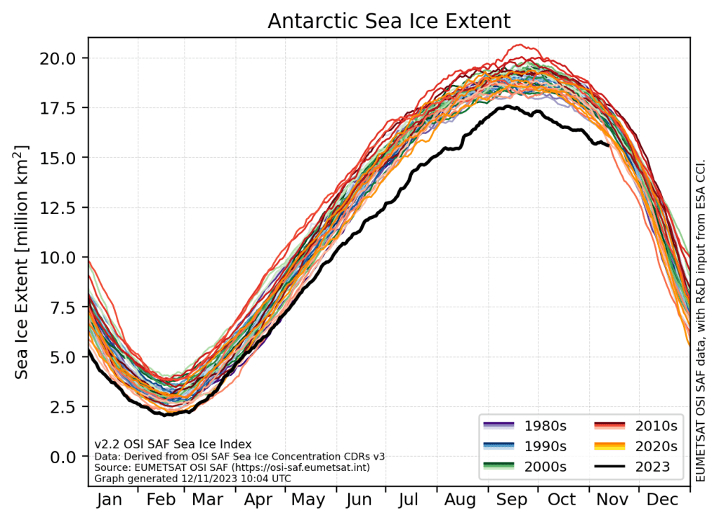
Monthly sea ice extent ranked by month also processed by OSI SAF. 2022 and 2023 are both extremely low.

In August, you could read on Videnskab.dk that the continent had failed to restore so much sea ice compared to normal that it was equivalent to the size of the world’s largest island, Greenland, or about 50 times the area of Denmark.

Since then, some of what was lost has been recovered, but when the sea ice peaked in September 2023, 1.75 million square kilometres of sea ice was still missing. This is equivalent to about 40 times the area of Denmark.

Antarctic sea ice extent in 2023, produced by the Eumetsat satelliute processing facility OSI SAF. The plot is updated daily and can be downloaded from: https://osisaf-hl.met.no/v2p2-sea-ice-index along with other data products.

This is by far the lowest amount of sea ice ever measured in Antarctica.

“The melting sea ice in Antarctica is not unexpected in itself, because we have long predicted that it would disappear due to global warming,” Ruth Mottram, senior climate researcher and glaciologist at the Danish Meteorological Institute (DMI) tells Videnskab.dk.

The climate seems to be changing before our eyes.

2023 has seen record high temperatures both on land and in the sea, which you can read more about in the article ‘Is the climate running out of control like in ‘The Day After Tomorrow’?

“But to suddenly have a very, very large disappearance like that is a big surprise. We can’t explain why it happened, and our models can’t recreate it either,” she says, but adds that over time, the models are getting closer to reality.

Disturbances in the Earth’s system are probably connected

Videnskab.dk has in a series asked five leading Danish scientists to assess the state of the climate from their chair – in this article Ruth Mottram.

Ruth Mottram is head of the European research project OCEAN:ICE.

The OCEAN:ICE project
The researchers in OCEAN:ICE, led by Ruth Mottram as principal investigator, will take measurements below the ocean surface. This will provide more knowledge about the temperatures in the ocean around Antarctica.
They will also calculate how fast the ice is melting in Antarctica due to ocean processes and warming in the air. They will also investigate what the lack of sea ice means for the rest of the Antarctic system.
Ruth Mottram cites as examples:
How does it affect ecosystems? For example, many animals feed on the small crustacean krill, whose life is affected by sea ice. Will more waves now reach the Antarctic ice sheet and perhaps lead to more icebergs and more melting? Will glaciers and icebergs become more sensitive to heat? Or, on the contrary, will less sea ice trigger more snow over the continent, which could even stabilise the glaciers?
More specifically, researchers will focus their efforts on seven areas, which you can read more about on the OCEAN:ICE website.

In the project, researchers will, among other things, take measurements under the sea surface in Antarctica to gain more knowledge about how the ocean and ice interact.

Is melting sea ice linked to warm water in the Atlantic?

In the North Atlantic, sea surface temperatures in some places have been as much as five degrees above normal.

To an outsider, it seems obvious that this could have something to do with melting sea ice.

However, according to Ruth Mottram, the two factors are not necessarily directly related. Sea ice in Antarctica melts from below. Therefore, the temperature at the bottom of the sea is far more important than the temperature at the surface.

“But if there’s one thing I’ve learnt over the past 15 years working at DMI, it’s how interconnected the whole world is. So I think we’re seeing some disturbances throughout the Earth system that are unlikely to be completely independent of each other,” she says to Videnskab.dk.

Ocean Professor Katherine Richardson made the same point earlier in the series. You can read about it in the article ‘Professor: The oceans are warming much faster than expected’.

Lack of knowledge and observations

Ruth Mottram emphasises that far more observations from Antarctica are needed before we can say anything definite about the causes of the rapidly shrinking sea ice, but: “It could indicate that the Antarctic sea ice has a critical tipping point like the Arctic, where for a number of years we see a slow decline year by year, and then suddenly it drops to a new stability where it is very low compared to before.””But we don’t know, because there are parts of the system that we don’t understand and that we haven’t observed yet,” explains Ruth Mottram.

Possible reasons why sea ice is disappearing

Ruth Mottram talks a lot with international colleagues about why the sea ice is currently experiencing a significant decline.

She explains that there are different theories, for example that warmer water from below is coming into contact with the sea ice and melting it from below, and that warmer air may be feeding in from above.

In Antarctica, the direction and strength of the wind has a big impact on the state of the ice (click here for a scientist’s timelapse of how Antarctic weather changes rapidly).

Perhaps the sea ice has been hit by “a very unfortunate event”, where it is both being hit by warm water from below and being affected by weaker winds from changing directions, which is holding back the recovery of sea ice.

Again, more research is needed.

Melting ice also contributes to sea level rise, and the Earth is actually designed so that melting in Antarctica hits the northern hemisphere much harder than melting in Greenland. So, bad news for the ice in Antarctica is bad news for Denmark.

Even more bad news is on the horizon.

The natural weather phenomenon El Niño looks set to get really strong over the next few months. A so-called Super-El Niño will likely only make the world’s oceans even warmer.

“We know that the ocean is going to be really, really important in the future in terms of how fast the Antarctic ice is melting and what that will mean for sea level rise,” says Ruth Mottram.
We can’t just wish the world would look different

The climate scientist does not fear huge increases or a violent change in climate overnight, as depicted in the 2004 disaster film ‘The Day After Tomorrow’. She points out that even abrupt shifts in the Earth’s past climate have occurred over decades or centuries, not a few months or years. Still, Ruth Mottram thinks it makes sense to start talking a little more openly about how we tackle severe sea level rise – which on a smaller scale can still be sudden – and large-scale climate change.

The Antarctic ice sheet is the largest on the planet

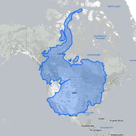
Figure made on http://www.thetruesize.com showing how Antarctica is roughly 1.5 times the size of the USA.

The Antarctic ice sheet contains around 30 million cubic kilometres of ice. This means that around 90 per cent of all fresh water on Earth is frozen in Antarctica.

If all the ice sheet in Antarctica melts, the world’s oceans will rise by around 60 metres. Even if we stay within the framework of the Paris Agreement, we risk that melting Antarctic ice from Antarctica will cause sea levels to rise by 2.5 metres.

Ruth Mottram notes that the more we exceed the limits of the Paris Agreement, the faster sea levels rise – and slower if we act quickly and stay close to the set limits of preferably 1.5 and maximum 2 degrees of temperature rise compared to the 1800s.

“The Earth’s climate system may be shifting towards a new equilibrium, which could result in a different world than we have grown up with,” continues Ruth Mottram.

“It is already affecting us and will do so increasingly in the future. That doesn’t mean it will be a total disaster, but we will probably get to the point where we have to adjust our lifestyles and societies.”

“It won’t necessarily be simple or easy to do so, but we can’t just wish for the world to be different than it is,” says Ruth Mottram.

In another article in Videnskab.dk’s climate series, Professor Jens Hesselbjerg Christensen notes that the world’s finance ministers – including Denmark’s – must pull themselves together and find money to slow climate change by, among other things, putting a cap on greenhouse gas emissions.

“We are in the process of allowing future generations to accept that large areas of land will become uninhabitable because the water level rises too much,” he says.
‘Bipolar’ researcher: Keep an eye on Greenland too

In the short term, Ruth Mottram is interested in finding out what the consequences of El Niño will be and how Antarctica will change over the next few years.

But she also has her sights set on Greenland.

“Because there have been so many weather events elsewhere, it has gone a bit unnoticed that we’ve had a really high melt season in Greenland this year.

“It can give us the opportunity to see very concretely how weather and climate are connected. That’s why the next few years will be really interesting in Greenland,” says Ruth Mottram, who has also conducted research in the Arctic for many years.

The next article in Videnskab.dk’s series on the state of the climate will focus on Greenland.

Translated with DeepL

A Sea-Ice Free Arctic in 2016?

UPDATE: The Arctic Sea ice Outlook I mention in the post below has just been published for 2016. We will follow this up in September when the final results will be known, but here are the 30 entries using a rage of different techniques including sophisticated computer models, statistical estimates and what is kindly called “Heuristics” but which may be characterised as an educated guess by people who have been studying this field for a while…

sio_2016_fig_1_30june

Professor Wadhams has not contributed an estimate this year but it can easily be seen that none of the estimates reach as low as the putative 1 million square kilometres. Nonetheless the view of 27 expert climate scientists put forward by Kay, Bailey and Holland (pdf), not to mention the very sophisticated RASM model (one of the most sophisticated in this area, run by the US Naval Postgraduate school), put the September extent at a very low 3-4 million km2, in the same range as the record low of 2012.

It will be interesting to see how low it does go. The latest results from the polar portal show that Arctic sea ice is currently still on the record low 2012 line but a careful look shows also that the 2012 and 2013 curves diverge around mid to late June. The year 2013 is pretty representative of a “new normal” over the last 4 years or so, it is therefore difficult to tell based on simply extrapolating along the curves which path 2016 is likely to follow.

SICE_curve_extent_LA_EN_20160711.png
The area covered by at least 15% sea ice in the Arctic from 1981 to present, the black and red curve shows the year 2016 and is updated daily on the Polar Portal 

The current weather plots on the Polar Portal (based on weather forecasts produced by the European Centre for medium Range Weather Forecasting, probably the best numerical weather model in the world) show no unusual temperatures in the Arctic Ocean right now, though parts of Arctic Canada and Siberia certainly look warm.

Wthr_Anom_SM_EN_20160711.png

We’ll have to wait and see until September…

Original post below from June, 14th, 2016. 

The Polar Portal has become part of our daily life at DMI where I work in the last few years, it combines detailed observations and models from the Greenland ice sheet, the Arctic sea ice and, soon hopefully, permafrost. I am particularly involved in the Greenland pages where we daily calculate the amount of snowfall and snow melt which gives us a surface mass budget and which we sum up over the year to work out what it means for the health of the Greenland ice sheet. This year has been especially interesting with an extraordinarily early start to melting driven by warm Arctic temperatures. Many records in Greenland have been broken in April, May and June. Spectacularly, last week Nuuk set a new temperature record for June that managed to last only 24 hours, before it was broken again.

This is the new reality in the Arctic. And it is also having an effect on sea ice. The Arctic sea ice extent has long been used as a bellwether of climate change with much effort exerted by both activists and sceptics in trying to prove or dismiss claims about climate and its effects on sea ice.

DSC02322.JPG
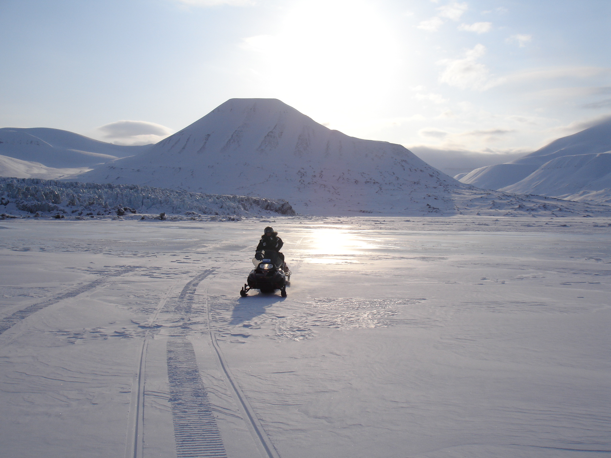
Crossing the sea ice in front of Paulabreen, a surge type glacier with a calving front in Svalbard

I trained as a glaciologist originally,  but even then I came across sea ice and was first of all unnerved by it, crossing on scooters to visit glaciers in Svalbard, and then fascinated by it. Recently I have been working pretty closely with my colleagues in DMI who are sea ice scientists and I have learnt quite a lot. We even published a paper together in the journal Polarforschung earlier this year. Not only that, I am now part of a big ERC Synergy project known as ice2ice  with scientists at four institutions in Bergen and Copenhagen working on the complex connections between sea ice, ocean, atmosphere and ice sheet in the Arctic. More on that another time, but suffice to say it’s fascinating work and I know a hell of a lot more about sea ice than I did even three years ago.

So when this news story crossed my email this evening courtesy a BBC researcher and journalist I knew pretty well straight away what it was about. Basically the scientist Professor Peter Wadhams had made some statements about the extent of Arctic sea ice which might be considered somewhat eyecatching.

Capture-wadhams

Professor Wadhams is a well-known scientist who did some incredibly valuable and indeed ground-breaking early work on sea ice. More recently he has also done some very valuable work reconstructing thickness based on submarine observations during the Cold War (see below on why this is important). I well remember seeing him talk about this as a young graduate student, he is an excellent speaker and gave a very interesting and compelling talk. In the last few years he has made several statements that have been widely reported and perhaps misinterpreted, with regard to the future fortunes of the Arctic sea ice.

Now, I need and want to be clear about this. Most of the global climate models we use are not very good at reproducing the observed historical sea ice extent. They have improved significantly in the last few years but still struggle to reproduce the actual observed decline in sea ice area from satellites. And there are actually very good reasons why this should be. There are some very good stand alone sea ice models which have done a very good job and the key difference between these models is our clue. Sea ice models are generally partly forced with actual observations, or climate reanalyses which assimilate observations, so the atmosphere and the ocean are close to reality. Basically sea ice responds to weather, and if you have a more accurate weather driving your sea ice model you will get a better fit to the observations.

So, is Professor Wadhams correct? Will the sea ice “disappear” this year.

Well, it is pretty clear that given the changes we have already observed in the Arctic, as well as what we know about Arctic amplification and the general direction that anthropogenic emissions are heading in, that unless something changes pretty soon, we will likely see an end to a significant cover of sea ice in the Arctic at some point in the next few decades. But was does that actually mean?

Reading his actual comments in the article he appears to define 1 million km2 as “no sea ice” and that partly reflects how we define sea ice extent. Since most of the data sets use a cut-off figure (typically 15%) to define when a grid square or pixel is or is not a sea ice point. This is known as sea ice concentration and is really something of a hangover from the days when sea ice was observed from ships and an attempt was made to estimate how much sea ice in the area  was around the vessel.

There are however lots of things that can affect sea ice extent, including winds and currents and melt ponds. The latter also affects how different algorithms assess the area that is or is not covered by sea ice. As there are a number of different sensors in use and a number of different algorithms processing that data, it is not entirely surprising that there actually a number of different estimates (I will use OSISAF) for how much of the Arctic is covered in sea ice. And this number will vary in years with more winds for example, or stronger ocean currents, sea ice will disperse faster. It is quite likely that much of the variability in sea ice area in recent years is at least partly attributable to different winds, as well as, for example in 2012, big storms that have arrived at just the right moment (or wrong one depending on how you look at it), to break up the sea ice into smaller, more easily transportable pieces.

As an aside, a better measure for how much Arctic sea ice there is actually present is sea ice volume. Unfortunately this is very difficult to measure, especially outside the winter freeze up season, though a research group at the UCL, centre for Polar Observation and Monitoring have developed a way to do so. Here for example is the most recent plot, which as you can see has not been updated since May 2016 due to the presence of melt ponds on the surface of the sea ice which the Cryosat radar cannot penetrate.

So 1 million km2 is probably a reasonable cut off for assuming an “ice-free” Arctic in the sense that it indicates that there will still be some sea ice drifting around (it always forms surprisingly quickly when the winter begins) in summer, even if it is dispersed.

Over the last 40 or so years (we have good observations going back to 1979, it gets patchy after that), in September, when the area covered by sea ice is at it’s lowest, that extent has been between about 7 and 9 million km2, more recently that has dropped and 2012, the lowest on record had an extent of about 4 million km2, which you can see on the latest polarportal sea ice chart below.

SICE_mod

I well remember 2012, we had a large melt event over Greenland that year also, but it was still quite a long way from the 1 million km2 quoted by Professor Wadhams. Again, let me be clear, we are pretty sure that at some point on a time scale of a few years to a few decades, the Arctic will become “ice-free” in the summer time. We can predict this, even if we don’t know exactly when, since, as I hope is clear now, sea ice conditions are very dependent on the weather. The weather this year so far, at least this Spring has been very warm and congenial to sea ice melt. The big dive shown on the graph above is no mystery when considering some of the temperature anomalies in the Arctic, as shown also on the Polar Portal.

Nevertheless, the recent plots seem to show that the 2 metre air temperature in the Arctic is returning to close to normal and there is little reason to suppose that will change significantly anytime soon.

meanT_2016

Having said that, weather forecasting has improved massively in the last few decades, a true quiet revolution, but we still do not know how the weather will pan out over the whole of this melt season. I am sure that at some point Professor Wadhams will be proved correct, but we do not know when and it is even possible or rather likely that we will have a few years where we switch back and forth between ice free and not ice free conditions. So, the answer to the question I pose above is probably no. But don’t bet on it remaining so for too long.

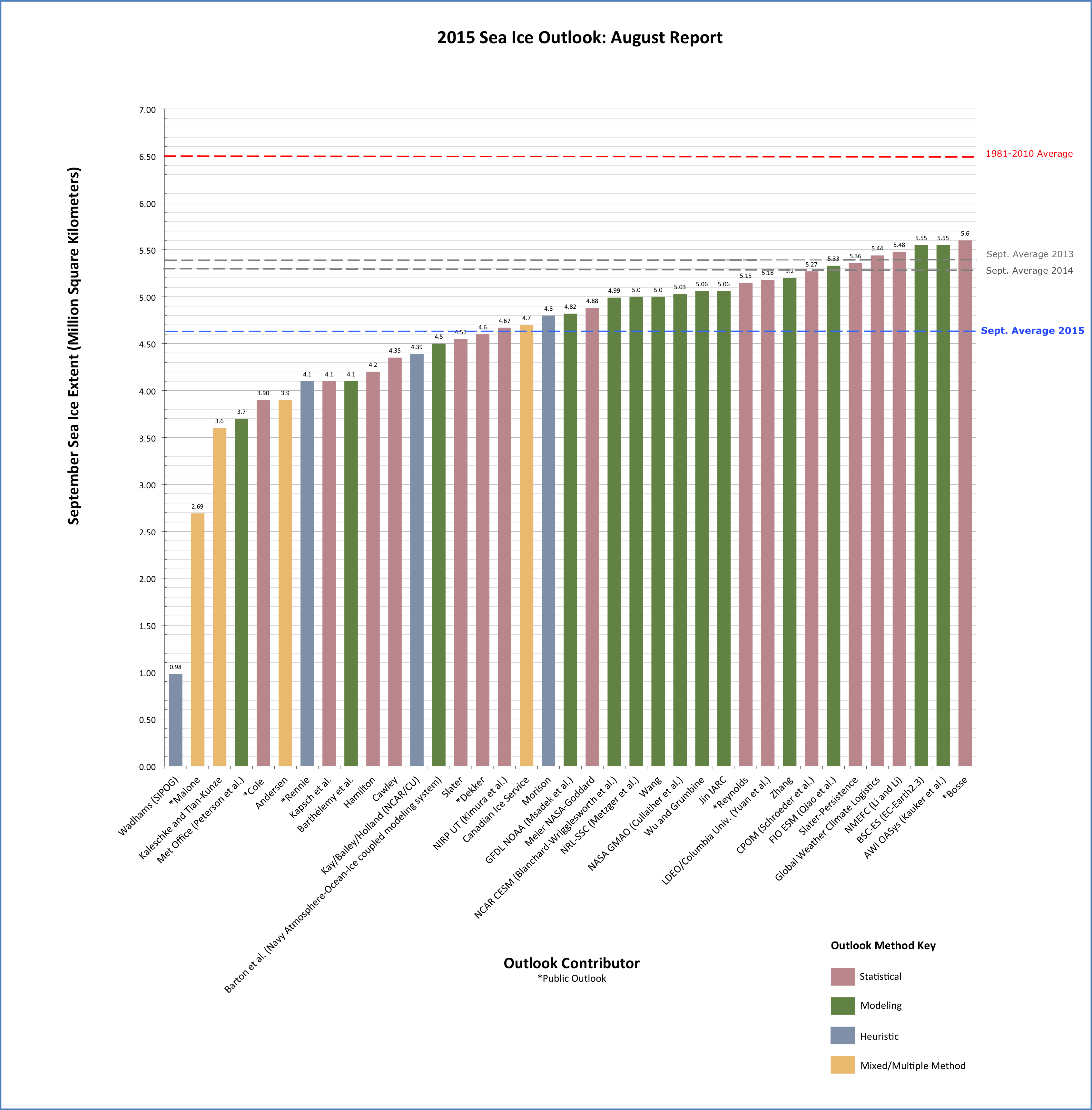
UPDATE: I recalled this morning on my way in to work that I had somehow failed to mention the Sea Ice Prediction network. This group of people under the auspices of ARCUS, gather predictions on y´the end-of-season sea ice extent ever year. The call for predictions for the 2016 season is now open. Many different research groups as well as one or two enthusiastic amateurs will post their predictions over the next few weeks. It is an interesting exercise, as you can see based on last year’s report (see also figure below), it is not the first time that Profgessor Wadhams has predicted a 1 million km2 extent in September, and his is the lowest (and least accurate) in the rankings.

figure_5
Downloaded from the ARCUS SIPN website

So keep an eye out on this and if you think you can do better, consider submitting a prediction yourself… 

Endnote: There has been quite an absence of posts from this blog recently. I have been too busy with work, family, travel and more recently the EU Referendum (for which I have been threatening a post for quite some time and may yet get around to before polling day). However, a question about Arctic sea ice has been flickering on the edges of my consciousness for a while now so this was a quick (EDIT: not so quick!) blogpost to try and address it when I should actually be writing something else…